안녕하세요 오늘은 NASA에서 어떤 우주의 모습을 비춰줄까요?
먼저 사진부터 감상하시죠!

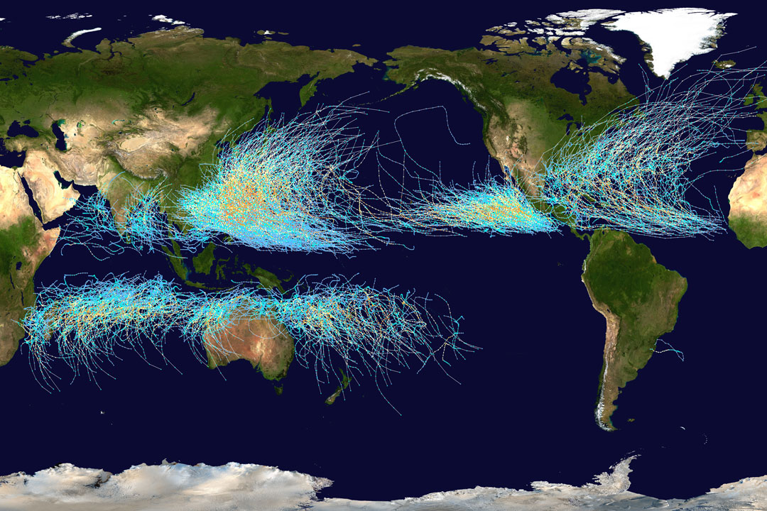
이 사진의 제목은 Cyclone Paths on Planet Earth 입니다. NASA에서 공식적으로 제공한 설명을 보시죠.
Where on Earth do cyclones go? Known as hurricanes when in the Atlantic Ocean and typhoons when in the Pacific, the featured map shows the path of all major storms from 1985 through 2005. The map shows graphically that cyclones usually occur over water, which makes sense since evaporating warm water gives them energy. The map also shows that cyclones never cross -- and rarely approach -- the Earth's equator, since the Coriolis effect goes to zero there, and cyclones need the Coriolis force to circulate. The Coriolis force also causes cyclone paths to arc away from the equator. Although long-term trends remain a topic of research, evidence indicates that hurricanes have become, on the average, more powerful in the North Atlantic over the past 30 years, and their power is projected to keep increasing. Follow APOD on Instagram in: English, Farsi, Indonesian, Persian, or Portuguese
오늘도 광활한 우주 앞에 인간이 얼마나 작은 존재인지 깨닫게 되네요.
저는 내일도 더 좋은 사진과 함께 돌아오겠습니다, 행복한 지구여행 되세요!
'나사사진' 카테고리의 다른 글
| NASA 오늘의 사진 (2021-09-17) (0) | 2021.09.17 |
|---|---|
| NASA 오늘의 사진 (2021-09-16) (0) | 2021.09.16 |
| NASA 오늘의 사진 (2021-09-14) (0) | 2021.09.14 |
| NASA 오늘의 사진 (2021-09-13) (0) | 2021.09.13 |
| NASA 오늘의 사진 (2021-09-12) (0) | 2021.09.12 |


